Latest Version
Version
1.1
1.1
Update
December 05, 2024
December 05, 2024
Developer
Technology Matters
Technology Matters
Categories
Design
Design
Platforms
Android
Android
Downloads
0
0
License
Free
Free
Package Name
org.terraso.landpks
org.terraso.landpks
Report
Report a Problem
Report a Problem
More About LandPKS Soil ID
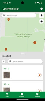
The Land Potential Knowledge System helps users access soil information and collect soil and vegetation data to inform sustainable land use and land management decisions. LandPKS is an open source suite of applications providing a tailored user experience for farmers, ranchers, restoration workers, land use planners, and more.
Soil ID features:
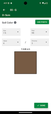
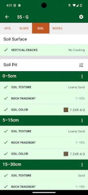
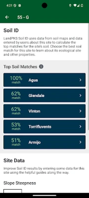
• Soil identification: Discover the soil type and ecological site by measuring key soil properties such as texture, color, and rock fragments.
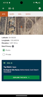
• Projects: Group and configure multiple sites and collaborate on data collection with a team. Managers can set required data inputs, user roles, and more.
• Custom soil depth intervals: Define soil depths according to what is observed at a site, or configure consistent depths for all the sites in a project.
• Enhanced notes capabilities: Add multiple searchable notes per site and share them with your team.
This release includes the basics of US soil identification and project management. We welcome testers and curious users. For monitoring vegetation and measuring soil health, use the legacy version for now.
Learn more at https://landpks.terraso.org
Rate the App
Add Comment & Review
User Reviews
Based on 0 reviews
No reviews added yet.
Comments will not be approved to be posted if they are SPAM, abusive, off-topic, use profanity, contain a personal attack, or promote hate of any kind.
More »


Popular Apps
Nanotechnology Dictionary AppEdutainment Ventures- Making Games People Play

Nanomaterials & NanotechnologyQuizOver.com

Might & Magic: Era of ChaosUbisoft Mobile Games
Nanonets Receipts & ExpensesNanonets

VCMI for AndroidVCMI Team

Truck Manager - 2025Xombat Development - Airline manager games

Heroes of Might: Magic arena 3Robin Blood

Good Soil PlusMighty Networks

Alto's AdventureNoodlecake

Snowboard Party: World TourMaple Media
More »


Editor's Choice

Galaxy - Chat Rooms & GamesGalaxy Chat

Google DocsGoogle LLC

Turbo VPN Lite - VPN ProxyInnovative Connecting
Pixel Art - Color by NumberEasybrain

Pixel DuelTumbirik

Pixel Car RacerStudio Furukawa

Puzzle Combat: Match-3 RPGSmall Giant Games

Combat Wear 2 - Wearable RPGStone Golem Studios

Combat Master Mobile FPSAlfa Bravo Inc.

WilderlessProtopop Games
